Planning for a warmer Victoria
Science Victoria Edition

Vice-President, Planning Institute of Australia Victoria &
Urban Planning Director, Hansen Partnership
When a new subdivision rolls out in Melbourne's outer suburbs, most of us see only the finished product: streets, houses, maybe a park. What we do not see is the paper trail behind it; the rezoning, the development applications, and the permit conditions that decided, years earlier, whether that land should have been built on at all.
That paper trail is the planning system. Quietly unseen, it's one of the most powerful tools Victoria has for adapting to climate change.
What planning actually does
Under the Planning and Environment Act 1987, every Victorian council is required to have a planning scheme. Most of us only have a passing familiarity with them – typically if we are looking to develop or renovate or to start a new business. Planning schemes set out what can be built where, and under what conditions, primarily through a set of zones and overlays. They are supported by state, regional and local policies, which are used where decisions are not ‘codified’ – that is, where a planner needs to make a decision rather than it being ‘as-of-right’.
Planning decides what future communities will have to contend with: where new homes go, for instance, whether they sit close to a train line; in a bushfire prone area; or near a creek that needs room to flood, especially as the climate changes. A house planned for an area covered by a Bushfire Management Overlay, for example, might be required to be built with fire-resistant materials and surrounded by a clear area of ‘defendable space’; a flood overlay might rule out construction of a basement.
The planning system can also enable other outcomes such as improved site permeability to minimise runoff during high rainfall events, or retention of trees to reduce urban heat, or precinct-scale energy generation to improve grid resilience.
These are not small technicalities. Once a subdivision – or individual development – is approved, and the roads, pipes and blocks laid out, and the buildings constructed, these are locked in for decades, or longer. Retrofitting a poorly located or laid-out suburb is far harder than doing things right the first time. Think about those subdivisions of the 1970s when cars were still the way of the future. They were rolled out without footpaths, and with courts and cul-de-sacs that are hard to navigate on foot.
Planning can play a mitigation role too: where and how densely we build shapes transport emissions for generations, since a home near jobs and public transport generates a fraction of the emissions of driving from one on the suburban fringe.
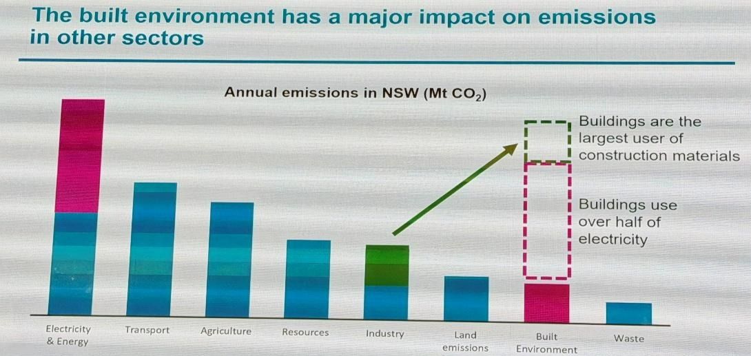
How and where we build matters, because the built environment arguably has the largest impact on carbon emissions if you take into account its contribution to other sectors (See Figure 1). This means that the planning decisions we make also represent one of the greatest opportunities to reduce carbon emissions.
A system still catching up
There have been recent changes in the objectives enshrined in Victoria’s Planning & Environment Act, which take climate change into account. But these have not yet been reflected widely in practice, and they have taken a backseat to the approval of dwellings under Victoria’s Housing Statement. Given that the planning system plays either a foundational or enabling role in the majority of mitigation and adaptation activities with respect to climate change, it is important that these objectives are more fully embedded into the varying controls which influence development outcomes.
Bushfire planning is an example of how this can play out. In May 2026, Amendment VC248 came into effect. It expanded the range of planning applications for which bushfire risk must be considered. They now include areas defined in the building system as bushfire-prone areas, not only those triggered by the presence of a Bushfire Management Overlay (Marcus Lane Group, 2026).
This followed a Tribunal decision, Booth v Strathbogie Shire Council [2023] VCAT 782, which found that bushfire policy was not a “relevant consideration” unless a specific control required it (Marcus Lane Group, 2026). In other words, without an explicit rule (generally an overlay) bushfire risk could be legally sidelined — even in fire-prone country. VC248 attempts to close that gap, though planning lawyers are already debating how far it reaches. A similar gap, where explicit permit triggers and overlays do not reflect the extent of known hazards, exists for other hazards such as flood and erosion risks
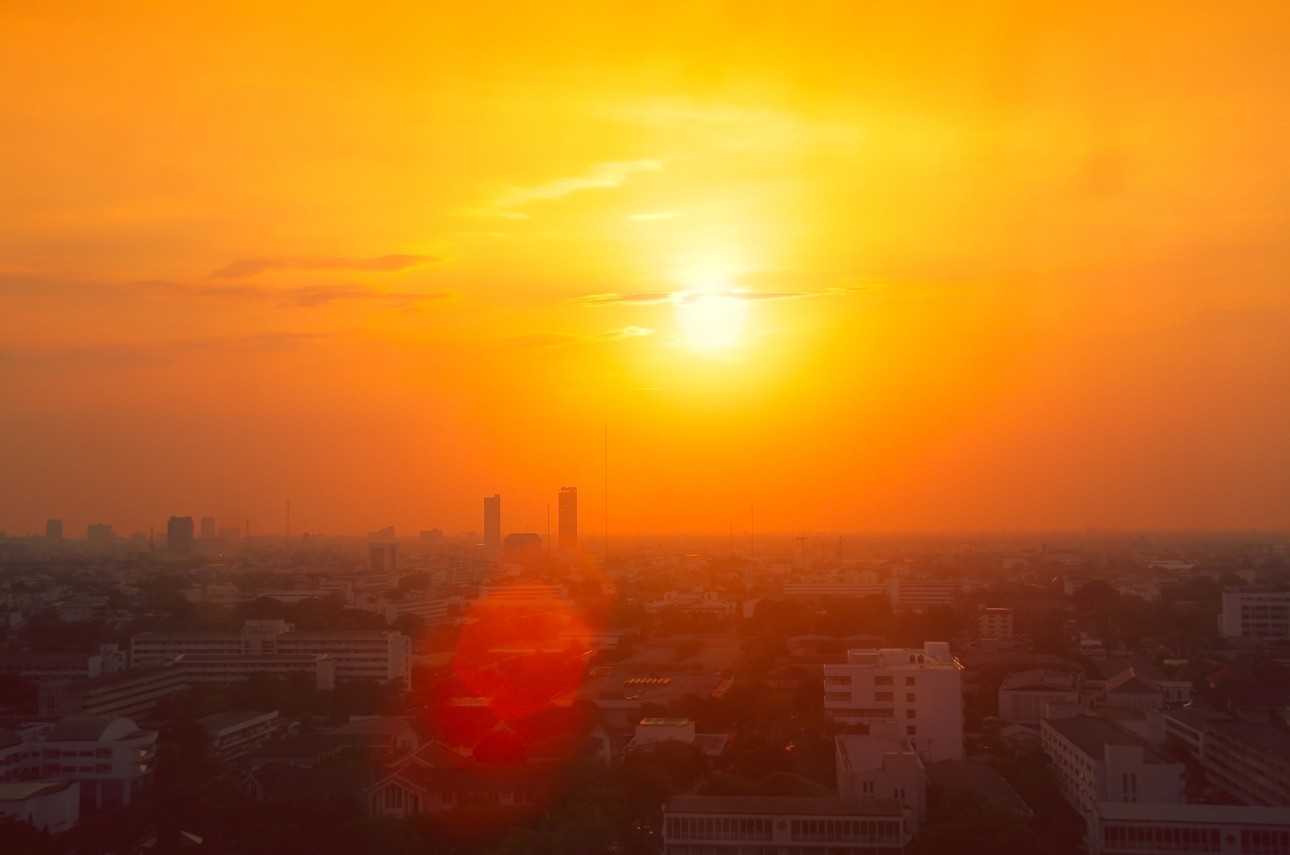
Heatwaves are Victoria's deadliest climate hazard. The layout of a suburb — tree canopy, orientation, how much dark pavement it has — determines how liveable it is in a 40-degree summer for decades to come. Housing approved today, either infill or greenfield, will still be standing in 2070. If today's decisions do not account for projected heat, flood and fire risk, no amount of emissions reduction elsewhere can undo that. There is still a lot of work to be done in that space
A pipeline of decisions
None of this is an argument against building. Victoria needs more homes. The job of planning is to make sure they go in the right places, and are built in a way which means they remain safe and liveable under climate change.
Bushfire protection shows what is possible when a hazard gets consistent treatment: the State maps bushfire-prone areas across every municipality and reviews that mapping every six months. This gives councils, insurers and applicants a shared, current picture of risk. Flooding and coastal erosion are not treated with the same rigour — and Victoria’s planning benchmark for sea level rise has sat unreviewed years after its update was flagged in Victoria’s Marine & Coastal Strategy (Planning Institute of Australia Victoria, 2024).
No single decision sets a suburb’s climate exposure. It takes a whole pipeline of decisions. Strategic plans decide where growth goes; precinct structure plans set the streets and lots; permits fix the detail; and, separately again, water and road authorities decide what of their particular infrastructure is built and when. They often adhere to different legislated objectives and use different data from the planners above them.
Large-scale precinct renewal is under way right now across Melbourne, yet there’s no requirement that these precincts be designed for net-zero carbon emissions, and a “climate change response plan” remains optional, according to the State’s own guidelines (Planning Institute of Australia Victoria, 2024).
Fixing that problem will not take one new rule, so much as whole-of-government realignment: and every stage of the pipeline – from the first rezoning, through precinct design and infrastructure funding, to the permit that lets a builder start work – should use the same hazard data, and have the same expectation that climate risk and emissions be considered actively.
The Victorian Government has a series of five-yearly Adaptation Action Plans (AAPs), across eight statewide systems. These include the ‘built environment’. The Built Environment AAP is an attempt to create a whole-of-government approach to actions required to strengthen climate resilience across the built environment, including updated planning provisions to address climate action. But these have not been robust and have lacked committed follow-through, according to the findings of a recent Parliamentary Inquiry. Beyond the built environment, the planning system also mitigates environmental impacts in other ways, through controls that provide protections for values including biodiversity, waterway health, and soil profiles.
As Victoria heads into COP31, most of the public conversation will be about targets and technology. But some of the most consequential climate decisions in this State are made quietly, suburb by suburb, permit by permit. These are decisions about where we build, and how well we build for a climate which is already changing.
References
[1] Hansen Partnership (2021), Climate change and planning in Victoria: Ensuring Victoria's planning system effectively tackles climate change. Report prepared for the Climate Change and Planning Advocacy Group. https://hansenpartnership.com.au/climate-change-and-planning-in-victoria-report/
[2] Marcus Lane Group (2026), Amendment VC248: Closing the gap on bushfire planning or creating new ones? [LinkedIn article]. LinkedIn. https://www.linkedin.com/pulse/amendment-vc248-closing-gap-bushfire-planning-creating-4zznc/
[3] Planning Institute of Australia Victoria, (2024). Submission to the Inquiry into Climate Resilience (Submission No. 258) [Submission]. Victorian Legislative Assembly Environment and Planning Committee.
Other articles of interest








Discover how you can join the society
Join The Royal Society of Victoria. From expert panels to unique events, we're your go-to for scientific engagement. Let's create something amazing.